Bedington Project
The proposed data center site is 638 acres, most of which is active farmland, in Bedington, Berkeley County, WV.
This site is situated within thousands of acres of farmland along the Opequon Creek within the Potamac River Basin.
It is encircled by over 550 acres of farmland protected forever under conservation easements and within a close proximity
of historic sites, nature preserves, schools, and residential communities.
How was this project approved?
The project in Bedington was announced as the first HB2014 certified High Impact Data Center (HIDC) on February 26, 2025
during a press conference at the West Virginia State Capital in Charleston. The event included Gov. Morrisey, state and
local government officials, and representatives of Penzance (the real estate firm that plans to develop the project and
lease the space to an undisclosed tenant). Local planning officials have stated that they were not involved with project
approval and only learned about it a few days prior to the announcement.
Documented
- Location: Berkeley County, WV on farmland in Bedington near the intersection of Bedington Road,
Scrabble Road, and Berkeley Station Road.
- Acreage: 637.2 acres
- Developer: Penzance (Washington DC based real estate firm)
- Managing partner and founder: Victor Tolkan
- Project LLCs:
- IT Load: over 600 MW
- Estimated Temporary Jobs: 1000+
- Estimated Permanent Jobs: 125+ (90k-110k each)
- From the WVDEP NPDES Storm Water Permit Application:
- Data center campus of about 637.2 acres (up from original plans of 550 acres)
- Multiple data center buildings with electrical infrastructure, cooling systems,
access roads, security buildings, utility connections, water treatment facilities,
and stormwater management improvements
- Initial grading will include 430.92 acres of disturbed land that will create about
1,000,000 cubic yards of fill. A borrow pit will be positioned north of Hoke Run
along Mouth of Opequon Road. Rock removal will involve heavy ripping and possibly
blasting.
- Runoff drains to Hoke Run and Opequon Creek, then the Potomac. The site has wetlands,
streams, nearby springs, and private wells, but no groundwater sampling data. The
application is still under DEP review and will go to public notice with a comment
period before approval.
Not disclosed
- Utility power load study
- Estimated average and peak water usage
- Water source and withdrawl location
- Impact studies and mitigation measures
- Cooling technology
- Server base
- Tenant
Site Map
Tick the boxes to turn each site's boundary on and off. The map stays
where you have left it; toggling a site only adds or removes its
outline. Disclaimer:
Loading maps…
Bedington Project site boundries were obtained from files sumitted with the WVDEP NPDES permit application. Farmland and protected farmland site
boundaries were retrieved from https://www.mapwv.gov/parcel/. All site boundaries are approximate. Notice
a missing farm or protected parcel? Let us know and we will add it.
The site today
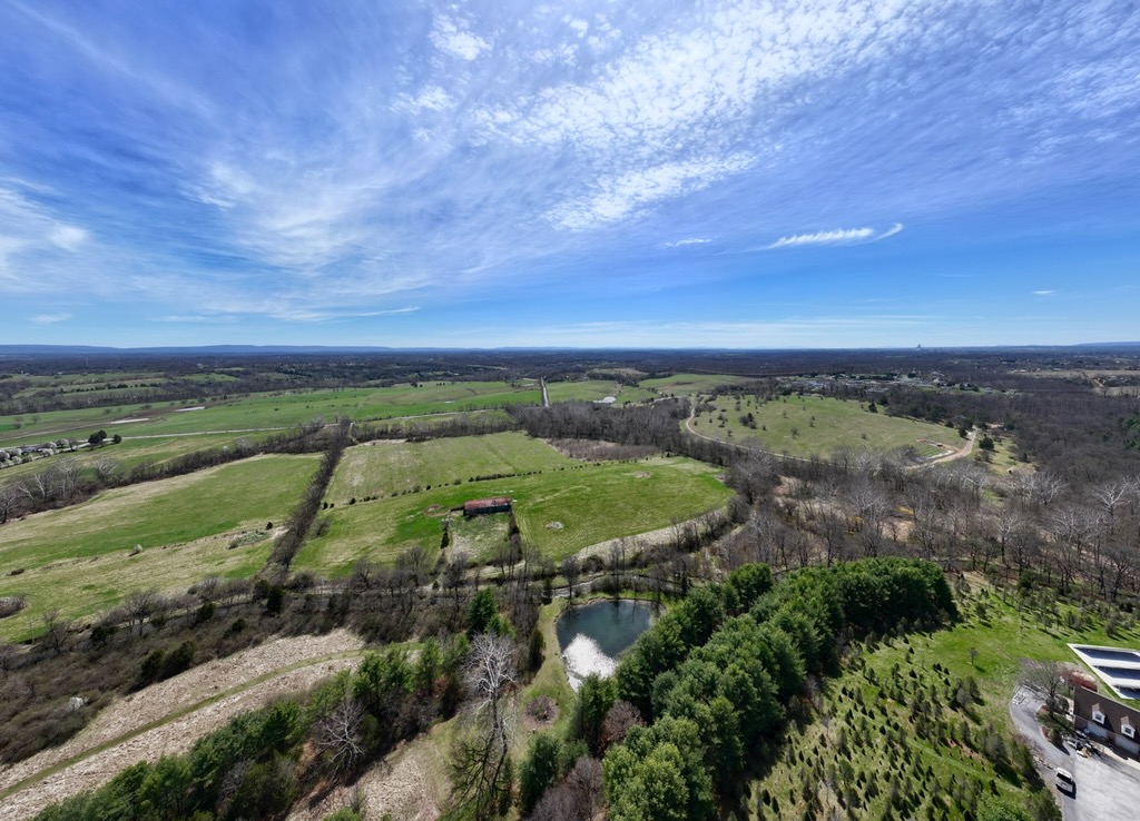
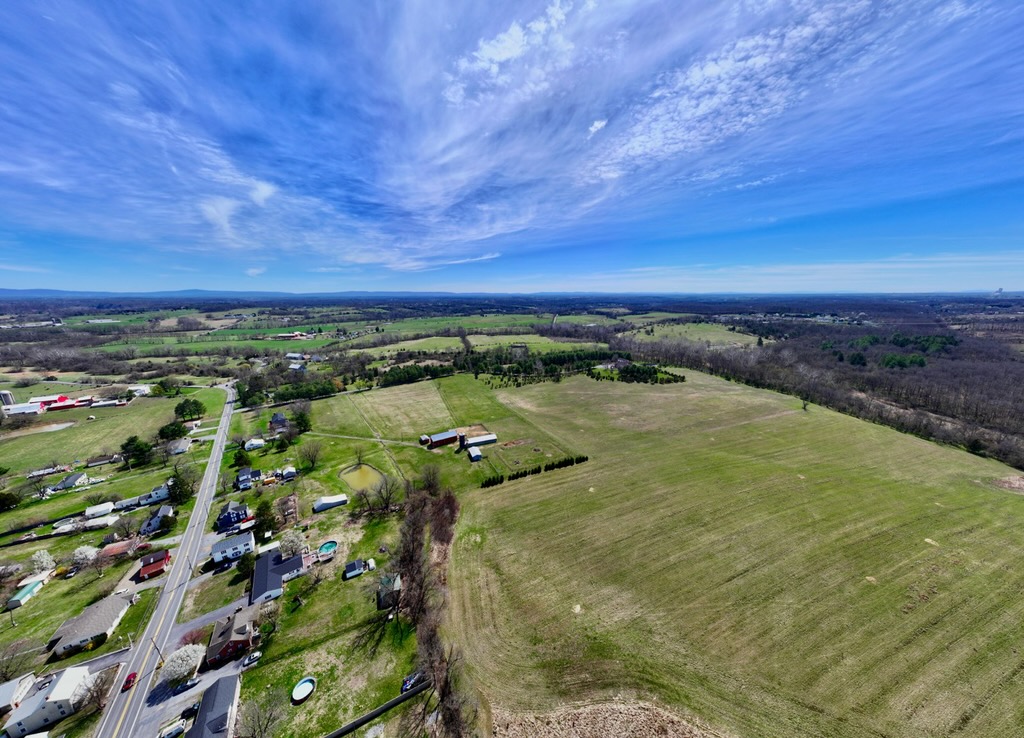
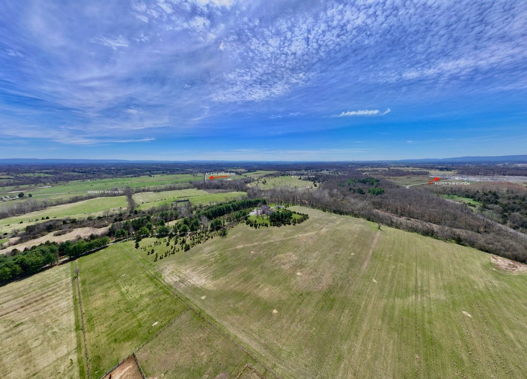
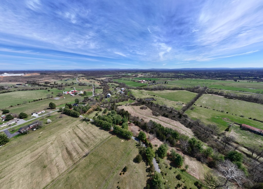
The following photos were taken of the parcels selected for the proposed Bedington Project. The area
is predominately farmland, including hundreds of acres of protected land on the site boundry.
Photos were taken by Nick Brathwaite.
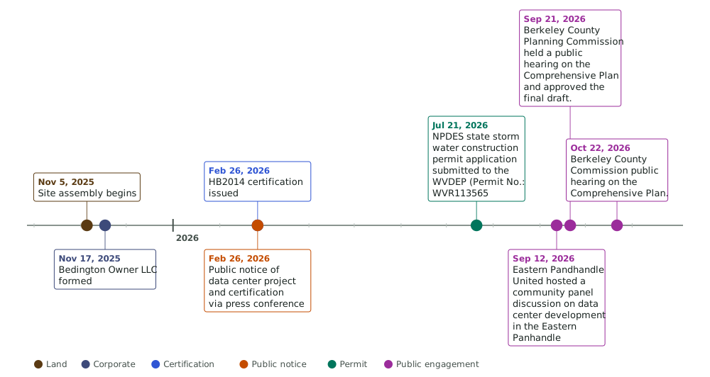
Timeline
Use the scrollbar to view the full timeline.
- Novemeber 5, 2025: Penzance Properties LLC completed the first purchase and sale agreement (5 total)
- Novemeber 17, 2025: Bedington Owner LLC, a subsidary of Penzance, registered to do business in West Virginia
- February 26, 2026: Governor Morissey announced the Penzance project in Bedington, WV as the first HB2014 certified High Impact Data Center
- July 21, 2026: Bedington Owner LLC submitted an NPDES/State storm water construction permit with the WVDEP (Permit No.: WVR113565). The application is still under review. A public comment period is expected soon. Stay tuned!
- September 12, 2026: Eastern Pandhandle United hosted a panel discussion about data center development in the Eastern Panhandle. The panel
consisted of political candidates, environmental experts, and community activists. Invitations were extended to the state Data Center
office, developers for Penzance and QTS, and incumbant elected officials who voted for HB 2014, however, these parties declined to send
representative to join the panel. A video of the dicussion is forthcoming.
- September 21, 2026: Berkeley County Comprehensive Plan was approved by the Berkeley County Planning Commission. The plan designates the area where the Bedington Project
is proposed as Sustain/Conserve.
- October 22, 2026: The Berkeley County Commission will held a public hearing and took public comments
on the draft Comprehensive Plan.
NOTE: There was no public notice prior to certification, and local county officials have stated they found out only days prior
Where To Go Next
-
Bedington Project
To date, construction has not begun and no construction permits have been approved.
Visit the Bedington Project page to learn more about this project.
-
Kearneysville Project
To date, construction has not begun and no construction permits have been approved.
Vist the Kearneysville Project page to learn more aobut this proposed project.
-
WV Resident Stories
Dedicated to highlighting and centering the voices of the residents of West Virginia who will be affected by these projects.
-
Take Action
The Eastern Panhandle data centers are not set in stone. These projects are still in the planning phase, construction has not begun,
and it is not too late to impact the outcome. So what can you do? This page outlines concrete steps you can take, including public comment periods an hearings,
voting, contacting your representatives, and community gatherings.
-
Law and process
Learn more about HB 2014 and other WV laws regarding data centers, county zoning, and the sequence of notice and public comment to date.
-
What Is A Data Center
There are various types of data centers that differ vastly in size and purpose. This page explains that difference and what types are being
proposed in WV.
-
AI Impact and Issues
Artificial Intelligence (AI) has the potential to bring significant benefit to society, but also poses significant risk without guardrails to ensure
safe and ethical use and implementation. This page provides an overview of the capabilities of AI technology that current regulatry governance does not
adequately address.
-
Common Claims
West Virginians have been hearing mixed messaging about the benefits, burdens, and need for data center development in the state. This page explains
some of the most commonly stated claims and clarifies what is actually true or known about each.